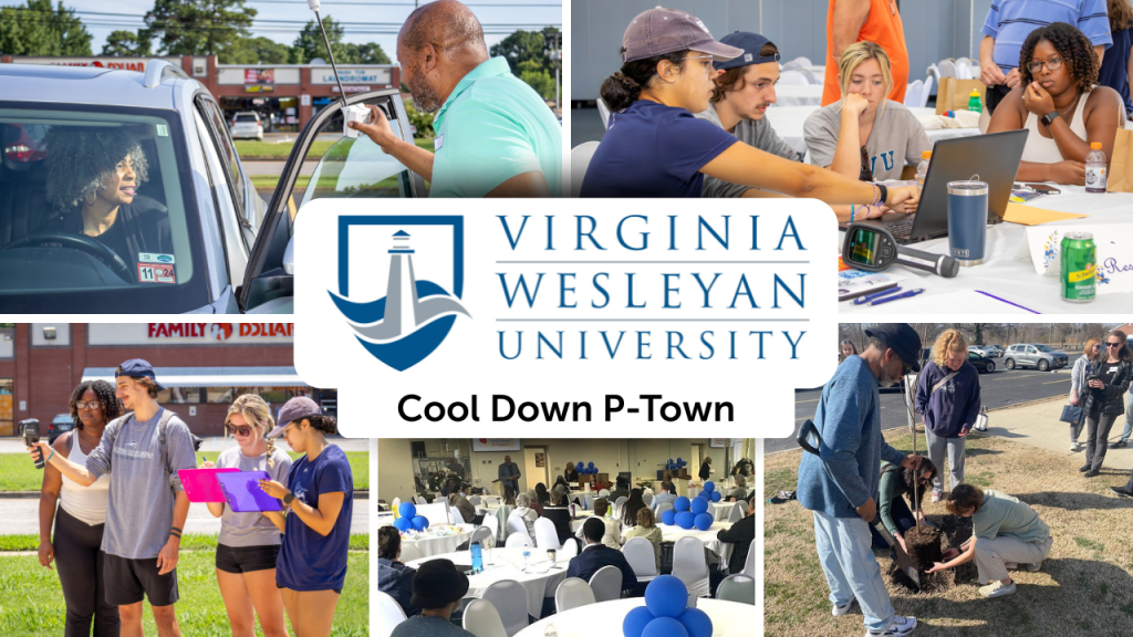

In Portsmouth, Virginia, extreme heat isn’t just a weather issue; it’s a matter of environmental justice. With limited tree cover, expansive concrete surfaces, and high rates of poverty and chronic health conditions, the city is facing a mounting climate crisis that hits hardest in its most vulnerable neighborhoods. However, a collaborative effort led by Virginia Wesleyan University (VWU) and the Center for Sustainable Communities (CSC) is working to change that, block by block, tree by tree.
A City at Risk
Portsmouth ranks high on the Social Vulnerability Index (SVI) at 0.84, well above Virginia’s average of 0.39 and the national average of 0.58, highlighting the disproportionate climate burden placed on its residents. These vulnerabilities concentrate in formerly redlined areas and majority-black neighborhoods where infrastructure and health disparities intersect with the growing threat of extreme heat.
“Portsmouth is significantly less affluent than neighboring cities like Virginia Beach,” said Garry Harris, Executive Director of CSC and co-lead of the project. “You see it in the heat. Wealthier areas have trees. Poorer areas have concrete.”
Backed by funding from the Virginia Department of Forestry’s Urban and Community Forestry Grant Program, the “Cool Down P-Town” initiative takes a community-first approach to heat resilience, combining community science, public education, and long-term policy change.
Naming the campaign Cool Down P-Town was a strategic move. “We designed ‘Cool Down P-Town’ to be approachable and empowering,” Harris explained. “The phrase itself avoids technical jargon and immediately connects with residents.” Instead of complex scientific terms, the approachable phrase quickly caught on and opened doors to deeper community conversations about heat, tree cover, and climate action.
Mapping the Heat
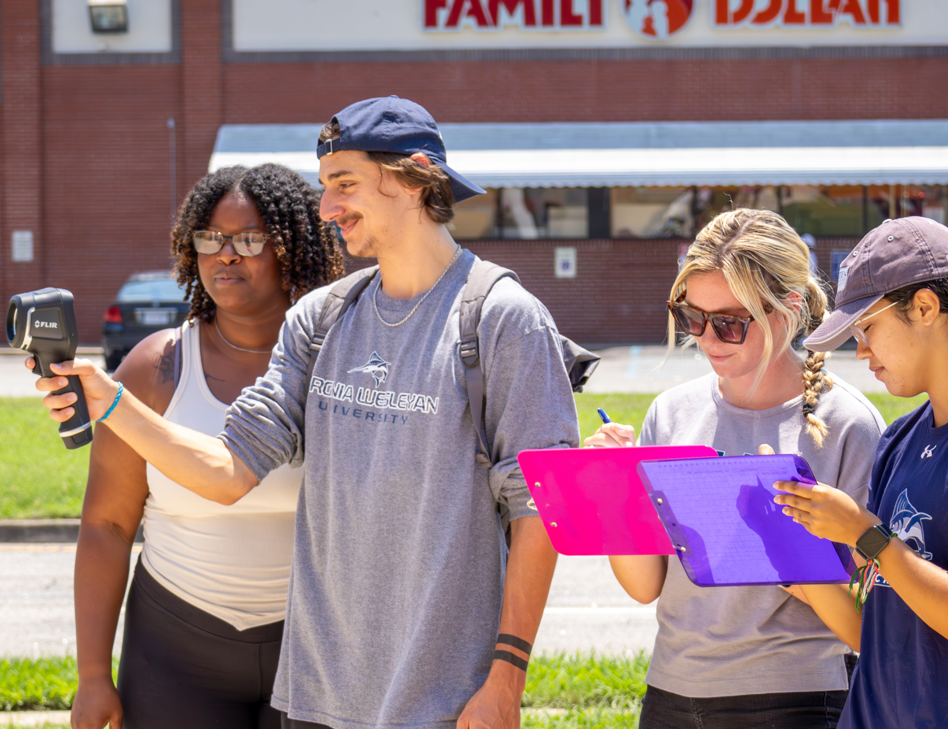
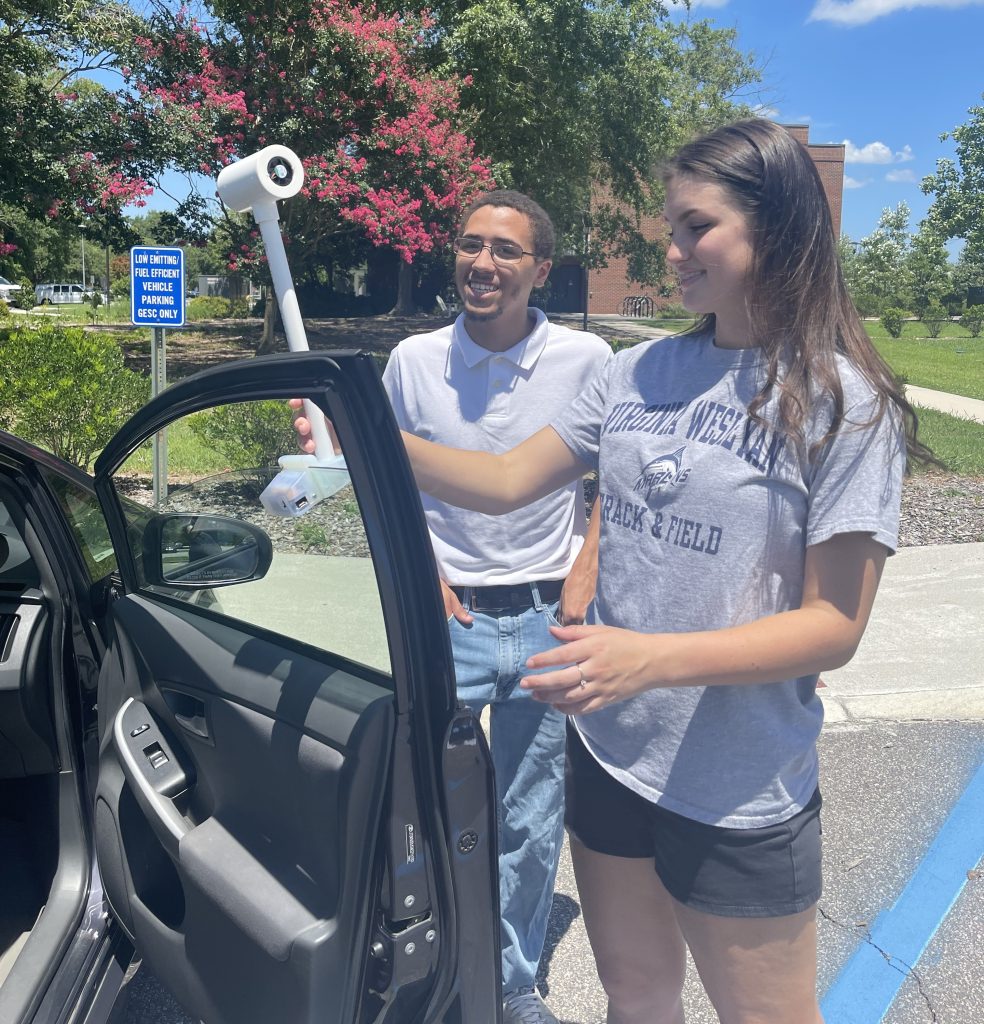
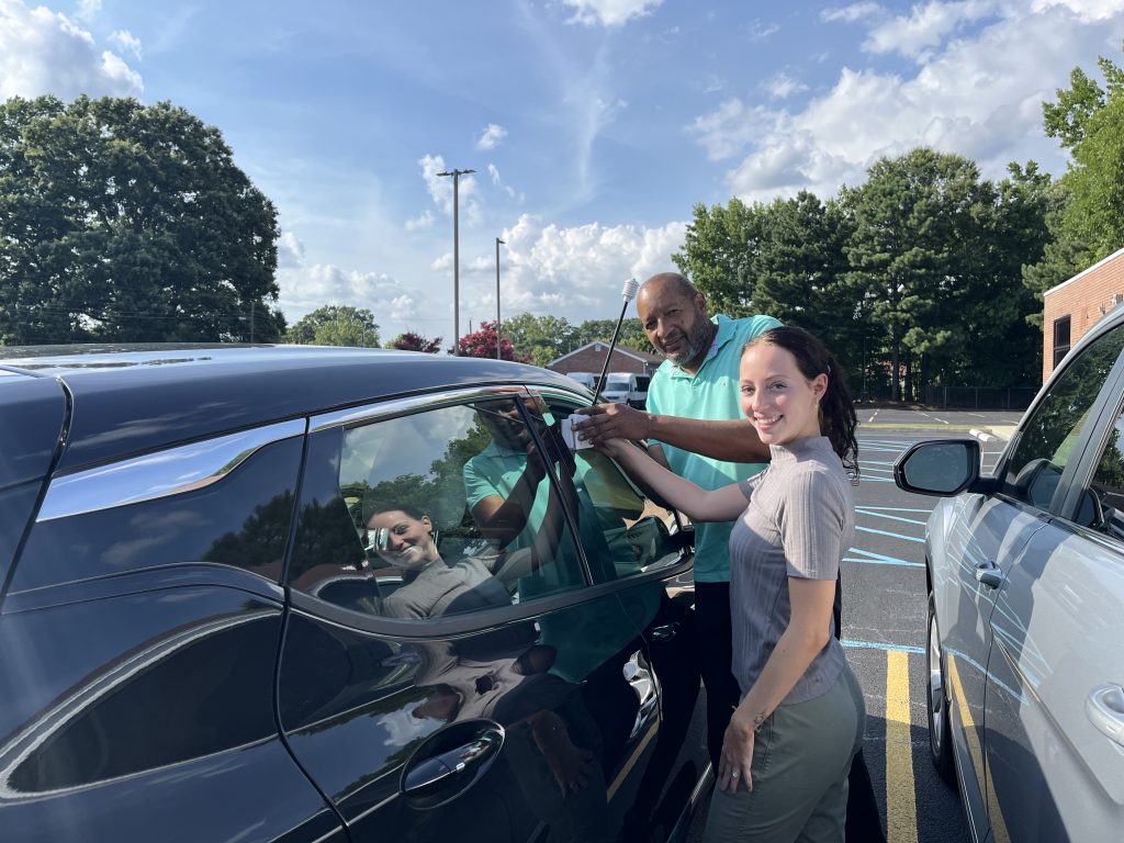
In the summer of 2024, volunteers fanned out across Portsmouth to collect real-time temperature and humidity data using equipment provided by CAPA Strategies. This community science effort followed a proven model for identifying urban heat islands. It yielded striking results: temperature differences of up to 9°F were recorded within a day, with the hottest zones aligning with low-income, low-tree-cover neighborhoods.
While a complete analysis of Portsmouth’s data is ongoing, preliminary findings from Virginia Beach, a nearby city previously studied by VWU, showed a clear pattern: areas with higher populations of people of color and low-income communities experienced significantly higher temperatures. Early data from Portsmouth is expected to confirm similar trends, reinforcing the systemic nature of environmental inequity.
The data collection effort also created hands-on learning opportunities for students. Several VWU undergraduates and one graduate student, majoring in related focuses like Earth and Environmental Sciences, Environmental Studies, and Education, participated in the project.
“This project allowed me to apply skills from my Intro to GIS course while also developing new techniques and a deeper understanding of the program’s applications. Geospatial information is a powerful tool for understanding the environmental challenges we face—and from that understanding, we can begin to address them. I plan to carry these skills forward into my master’s studies in Environmental Systems Sciences and Climate & Environmental Monitoring. More than anything, I appreciated the opportunity to work with meaningful data and contribute to something bigger than myself.”
– Elizabeth Smeltzer, Senior Environmental Studies major, VWU
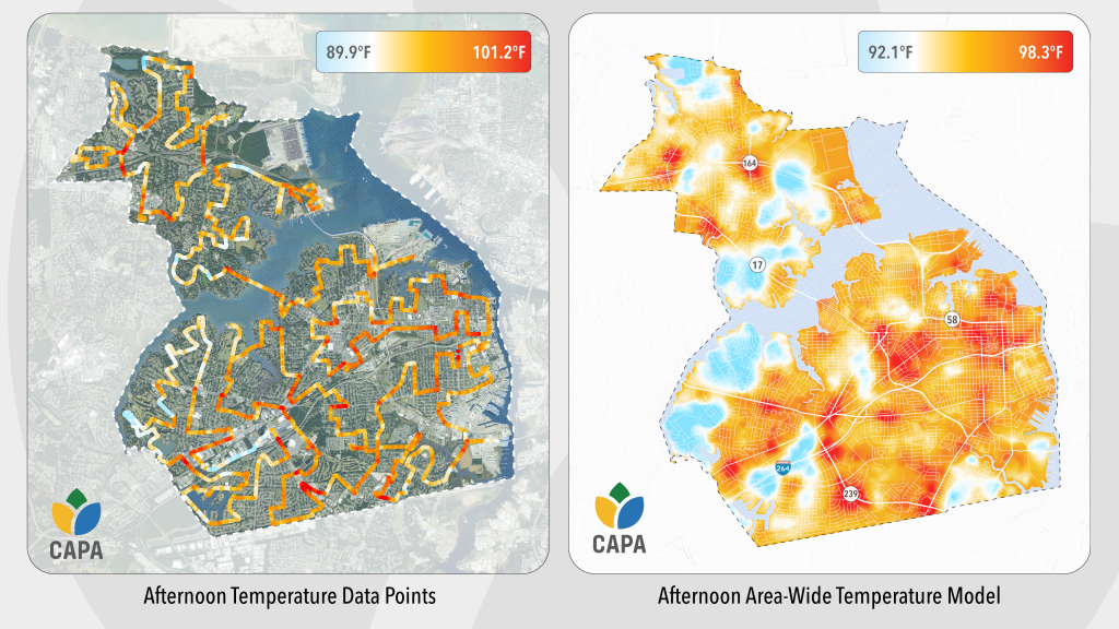
which reveals significant heat disparities across the city.
From Data to Action
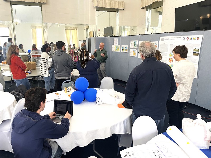
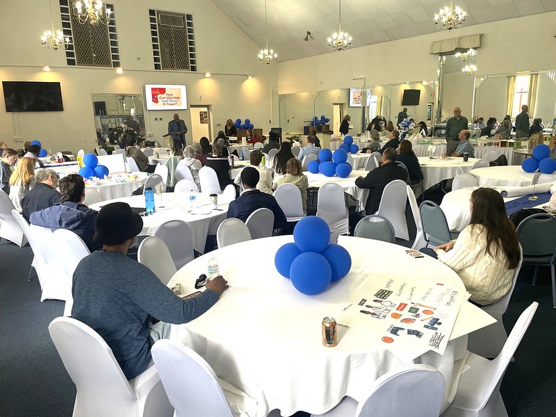
The data didn’t just stay in spreadsheets; it came to life in a town hall at New Bethel Baptist Church, a trusted community space now serving as a Resilience Hub. More than 40 residents and community partners gathered for a gallery walk of the heat maps and an open mic session, where personal stories gave weight to the numbers. “So many people shared experiences that they closed out the session,” Harris said. “It showed just how much this issue matters.”
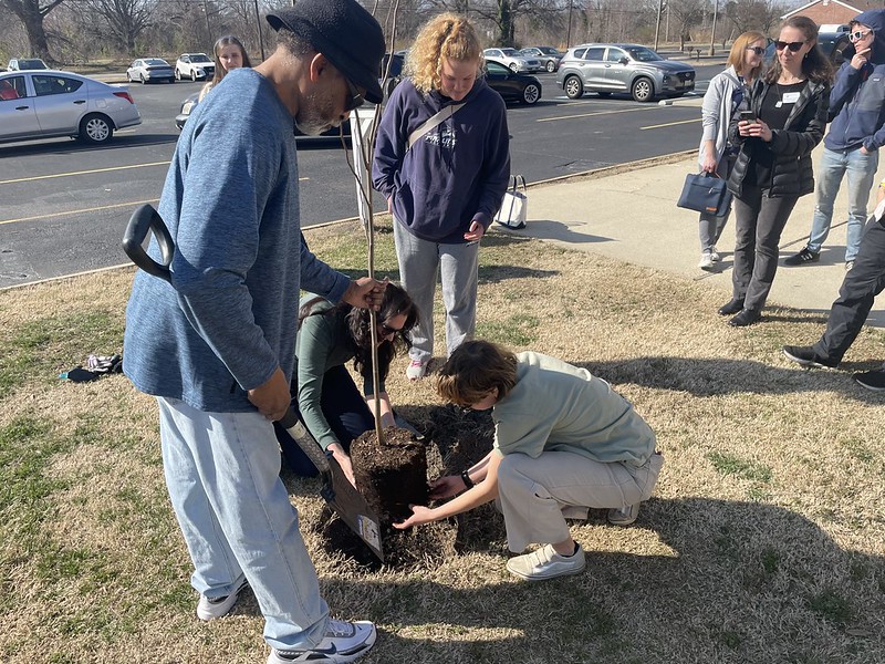
Four trees were planted at the church that day, a symbolic but tangible start to a broader plan. Over the next year, the project will remove asphalt and plant native and fruit-bearing trees in neighborhoods identified as high-risk using a combination of heat and demographic data, including metrics from the EPA’s EJScreen and the White House Climate and Economic Justice Screening Tool.
Justice-Driven, Community-Led
By layering heat mapping data with indicators like poverty, asthma rates, and transportation access, VWU and CSC ensure that resources go where they’re needed most. The effort is grounded in a philosophy Harris calls “just science,” a model that blends scientific rigor with a deep commitment to racial and climate justice.
The town hall wasn’t just a meeting; it was the kickoff of a movement. Residents voiced the need for better housing insulation, updated air conditioning, and more green space, concerns that are now shaping the project’s next steps. VWU students are developing lesson plans on urban heat islands and green infrastructure for local schools, while CSC is preparing policy recommendations for city officials.
“As a university rooted in service and sustainability, we’re proud to stand at the intersection of research and action—where data drives change and community voices shape the future,” said VWU President Scott D. Miller. “This is what it means to put our values to work.”
Growing Long-Term Resilience
The long-term vision for Cool Down P-Town is expansive. In addition to its immediate goals, like mitigating extreme heat through green infrastructure, the project lays the groundwork for systemic change. The Resilience Hub at New Bethel Baptist Church will eventually serve dual roles: a shelter with solar and better systems during heat emergencies, and a year-round community center offering food access, job training, and transportation assistance.
The project also plans to institutionalize tree protection policies, incentivize canopy expansion through zoning reform, and model Portsmouth’s resilience work after cities like Atlanta, which boasts a 47% tree canopy. CSC recently rebranded and expanded its outreach and mitigation efforts as “Trees Across Portsmouth,” better amplifying and immediately connecting the need for residents to engage in long-term resilience through tree and shrub planting and related efforts.
Partnerships with Starbase Victory and the Elizabeth River Project ensure ongoing support and educational outreach. At the same time, other collaborations signal a growing national interest in replicating the model elsewhere.
A Cooler, Fairer Future
Cool Down P-Town isn’t just a catchy slogan, it’s a community-led blueprint for climate justice. By centering science in the hands of citizens and solutions in the voices of residents, Portsmouth is transforming its heat crisis into an opportunity for empowerment.
As Harris put it, “This is about more than just temperature. It’s about who gets to thrive in the face of a changing climate.”